First federal fracking regulations in 30 years

US Department of the Interior

US Department of the Interior

The regulation of hydraulic fracturing has recently been seen as a local and state government issue. After more than 30 years however, the Obama administration has unveiled the nation’s first major federal regulations. According to the Interior Department, the new laws only apply to federal lands and will affect around 100,000 wells. Continue reading

Posted in Energy, Hydraulic fracturing, Industry news, Oil & gas | Comments Off on First federal fracking regulations in 30 years

EnviroMentor program helps Boy Scout ranch meet regulations

TX EnvironMentor BoyScouts

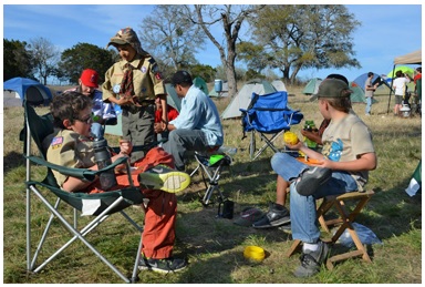
Thanks to the TCEQ EnviroMentor program, Central Texas Boy Scouts will soon be able to safely hydrate using water from a water well on site.

Government regulations have a reputation for being difficult to understand and comply with. Luckily, the TCEQ has an answer for this issue in Texas. The EnviroMentor program aids small businesses, non-profits, and local governments in meeting state environmental regulations. The program is supported by many environmental specialist volunteers. One important aspect of the program is that the assistance is provided confidentially and therefore without the threat of compliance enforcement. Recently, volunteers and environmental professionals Therese Baer, P.E. and Rosemary Wyman, P.G. were able to help a Boy Scout ranch and day camp facility near Liberty Hill, Texas come into compliance. Continue reading

Posted in Groundwater, Regulatory issues, TCEQ, TX | Comments Off on EnviroMentor program helps Boy Scout ranch meet regulations

Supreme Court ruling over Republican River a victory and a loss

This past week the Supreme Court made a decision on the decades long debate over the Republican River mandating that Nebraska pay Kansas $5.5 million in damages for violating the terms of the Republican River Compact. Both states claim this ruling as a win, but did both really come out equitably? Continue reading

Posted in Analysis, Regulatory issues, Surface water | Comments Off on Supreme Court ruling over Republican River a victory and a loss

Google Earth Pro is now free

Google Earth is a useful tool that allows you to explore any location in the world. You can view different imagery layers and even overlay a few historical aerials. The search features allow you to zoom anywhere in the world and view places in 3D or street view. Google Earth is a handy way to share site information too, our clients often send us site maps created by Google Earth. Or you can map a portfolio of sites and save as a KMZ file which can be shared easily. Continue reading

Posted in Aerial photography, Geomapping, GIS, Technology | Comments Off on Google Earth Pro is now free

Managing lake levels in Texas

Central Texas has been enduring a drought for many years. However, according to the Texas Water Development Board, drought conditions are the best they have been since November 2010. Which is good news: with the rapidly growing population of the city, water resources are becoming increasingly important.

The Lower Colorado River Authority (LCRA) board recently approved a $214.9 million reservoir project 60 miles southwest of Houston. The project is designed keep Austin hydrated and thriving, while capturing additional rainfall. The regions is currently in La Nina weather pattern, in which northern and eastern states receive above-average rainfall and powerful hurricanes, but the average level of rain in the southern and southwestern states diminishes.

Continue reading

Posted in Austin, Surface water, TX | Comments Off on Managing lake levels in Texas

Pennsylvania to form Geospatial Coordinating Board

Last November, the Pennsylvania House and Senate passed a bill to establish the Geospatial Coordinating Board. This board will consolidate maps and data from all levels of government to create a central repository for geospatial information.
Continue reading

Posted in Environmental data, GIS, Phase I ESA | Comments Off on Pennsylvania to form Geospatial Coordinating Board