Have you ever wanted to see what a place looked like in previous decades? This week’s post from Environmental Prose demonstrates how to georeference a historical aerial photograph in ArcGIS. See how we take an image from the 1950s and overlay it onto current aerial imagery to reveal changes in the ever-changing urban landscape of Austin, Texas.
How to georeference aerial photos
Texas Water Day at the State Capitol
 At the State Capitol on Thursday, The Texas Water Foundation held Texas Water Day. The Texas Water Foundation is a non-profit organization that aims to raise awareness of the state’s water resource issues and the importance of protection, conservation, and enhancement of water uses. The event brought together citizens, state and national water experts, and water organizations to discuss water resource issues facing Texans. The expanding drought has led to severe water shortages in the state and this Wednesday, the Texas House of Representatives passed House Bill 4 which creates a water infrastructure plan to address critical water issues across the state. This much needed infrastructure plan includes allocation of funds for conservation programs, which was celebrated by many of the speakers at the event.
Continue reading
Unprecedented water shortage in Wichita Falls, Texas
The Texas Tribune published an article this week on extreme water shortages in Wichita Falls, Texas. Last month lake levels dropped significantly, prompting Stage 3 water restrictions, and the city is expected to implement Stage 4 restrictions by the time the summer heat arrives. Texas drought conditions have never been this severe for Wichita Falls to date.
In response, the Times Record News of Wichita Falls reported that the TCEQ estimate on when the city would run out of water does not depict the full story. Daniel Nix, the city public works operations manager says city leaders are required to report to TCEQ whenever Stage 2 restrictions are implemented – but the options available for classifying how much water remains are limited to water outages in 45, 90, or 180 days.
Continue reading
Phase I ESA changes expected with ASTM E1527-13
 Many in the environmental industry are concerned about the upcoming proposed changes to ASTM E1527-05, the protocol established by the American Society for Testing and Materials (ASTM) to advise environmental professionals on best practices when conducting a Phase I Environmental Site Assessment. The revised standard, E1527-13, is an effort to provide clarity for site designation and add specific metrics absent from the previous standard.
Continue reading
Interview with veteran Texas GLO consultant Lannie Stimson
First of all, would you briefly describe the primary responsibilities of the Texas General Land Office (GLO)?
 The General Land Office was founded in 1836 and is the oldest state agency in Texas. The GLO is responsible for managing and maintaining public lands in the state of Texas, which consist of hundreds of thousands of acres and includes everything from oil and gas leases, to leasing land for people to graze cattle, and any public land that has potential for a greater generation of income via sale or long term lease of that land. The GLO also has an asset management department that oversees types of non oil and gas lands and keeps an inventory of the value of all the property that is on prisons, state parks, state public land, and more.
Continue reading
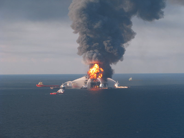
BP on trial for Deepwater Horizon disaster
Continue reading

