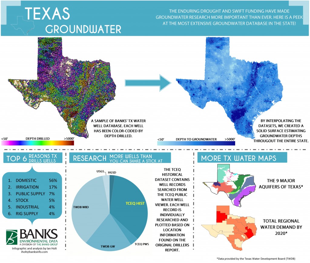
Summer is finally here and the longest drought in Texas history is still with us, highlighting our need for some good news about water. In true Environmental Prose style, we thought it would be exciting to open up our database and run some numbers – giving you a peek at the most extensive collection of water well records in Texas. With more than a half-million wells on file, our groundwater depth map is likely the most comprehensive in the state! #TXwater
 Ian Holt
Water Well Specialist
iholt@banksinfo.com


Pingback: Wichita Falls begins drinking treated wastewater - Environmental Prose